

You can find on this page the San Francisco bike map to print and to download in PDF. The San Francisco bicycle map presents the bike routes and lanes of San Francisco in USA.
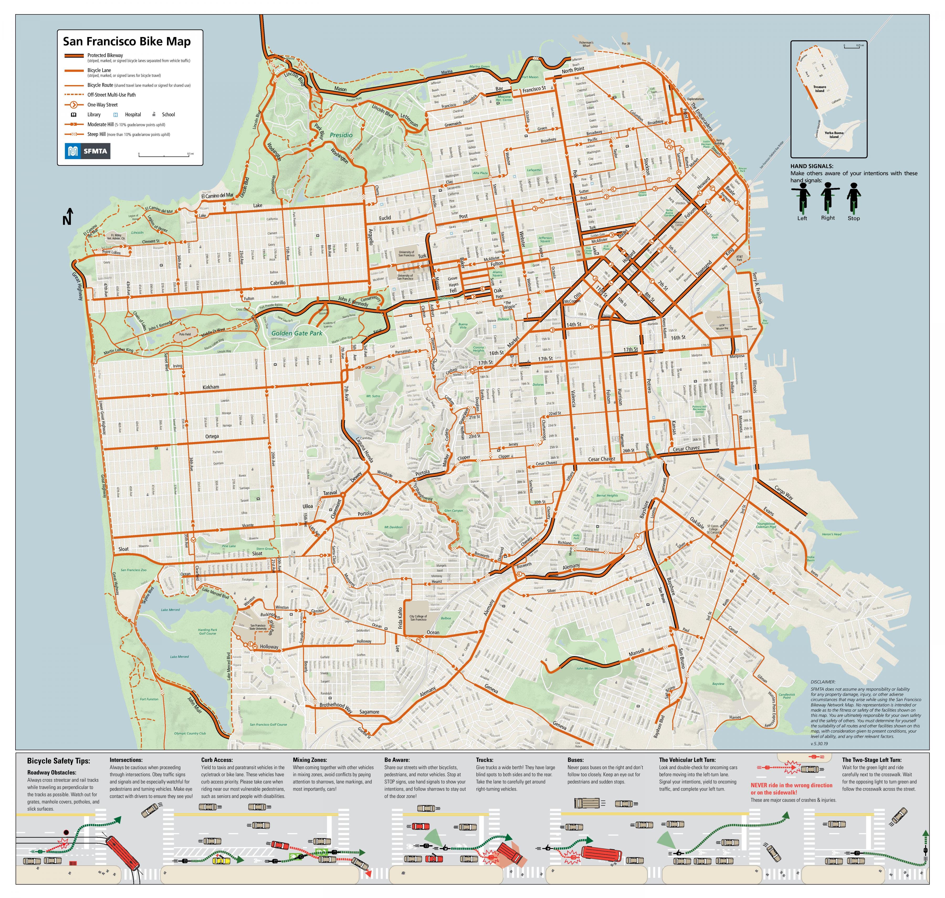
The San Francisco bike lane map shows all the bike routes of San Francisco. This bicycles lanes map of San Francisco will allow you to easily plan your routes with a bike in San Francisco in USA. The San Francisco bike lanes map is downloadable in PDF, printable and free.
The people of San Francisco love to be active, whether on land or in the water, and are among the fittest in the country. There are more than 320 km of bike lane paths, both to encourage healthy living and to reduce congestion. Rollerblading, biking and jogging are all popular activities of San Francisco, especially in the Marina Green and Presidio parks as you can see in San Francisco bike lane map.
San Francisco will create the new bike lane over the next two years. In 2017-2018, the San Francisco Municipal Transportation Agency (SFMTA) built protected bike lane at a pace of a little more than 5 miles a year (see San Francisco bike lane map); that pace would be doubled under Breed plan, her office said in a statement. “Since 2006, bicycling in San Francisco has almost tripled. As San Francisco continues to grow, we know we need more protected bike lanes, not only to keep people safe, but also to encourage more people to bike in the city and reduce congestion,”.
Biking is a popular mode of transportation in San Francisco. 75,000 residents commute by bikee per day. Bay Area bike line share was launched in August 2013 with 700 bikes in downtown San Francisco and selected cities south to San Jose (see San Francisci bike lane map). San Francisco has significantly higher rates of pedestrian and bicyclist lane traffic deaths than the United States on average.