

You can find on this page the San Francisco tram map to print and to download in PDF. The San Francisco trams map presents the network, zones, stations and different lines of the tramway of San Francisco in USA.
The San Francisco tram map shows all the stations and lines of the San Francisco tramways. This tramway map of San Francisco will allow you to easily plan your routes in the trams of San Francisco in USA. The San Francisco tram map is downloadable in PDF, printable and free.
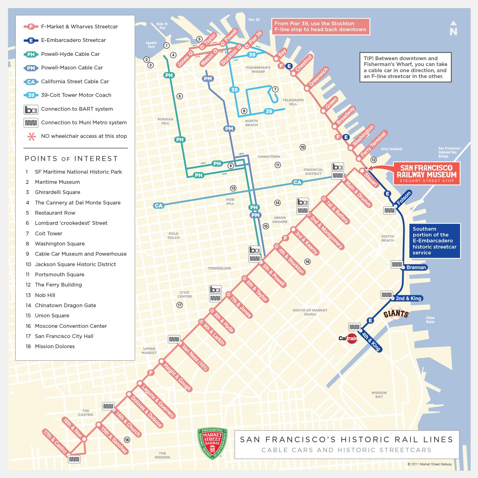
San Francisco is made up of old tramway cars from the inter-war period. San Francisco tram has 2 lines as its mentioned in San Francisco tramway map. The tramway line F connects the Embarcadero to Castro down Market Street of San Francisco, with passages every 5-10 minutes during the day. The tramway line E extends its route along the Embarcadero to the Caltrain station.
San Francisco is world-famous for its tramway that runs in the middle of the traffic: the Cable Car. The tramway turns under the roadway as its mentioned in San Francisco tramway map, thanks to an important machinery that can be visited, and drives the 3 lines of Cable Cars, the power of the tramway system in San Francisco allowing to play with the very steep slopes of the city as soon as you move away from the shore.
Tramway in San Francisco run outside in the suburbs but go down to an underground network in the city centre of San Francisco as you can see in San Francisco tramway map. There is also the historic "F Market tramway" which serves the streets between Castro Street and Fisherman Wharf. The tramway is a true icon of San Francisco and has been classified as a historical monument.